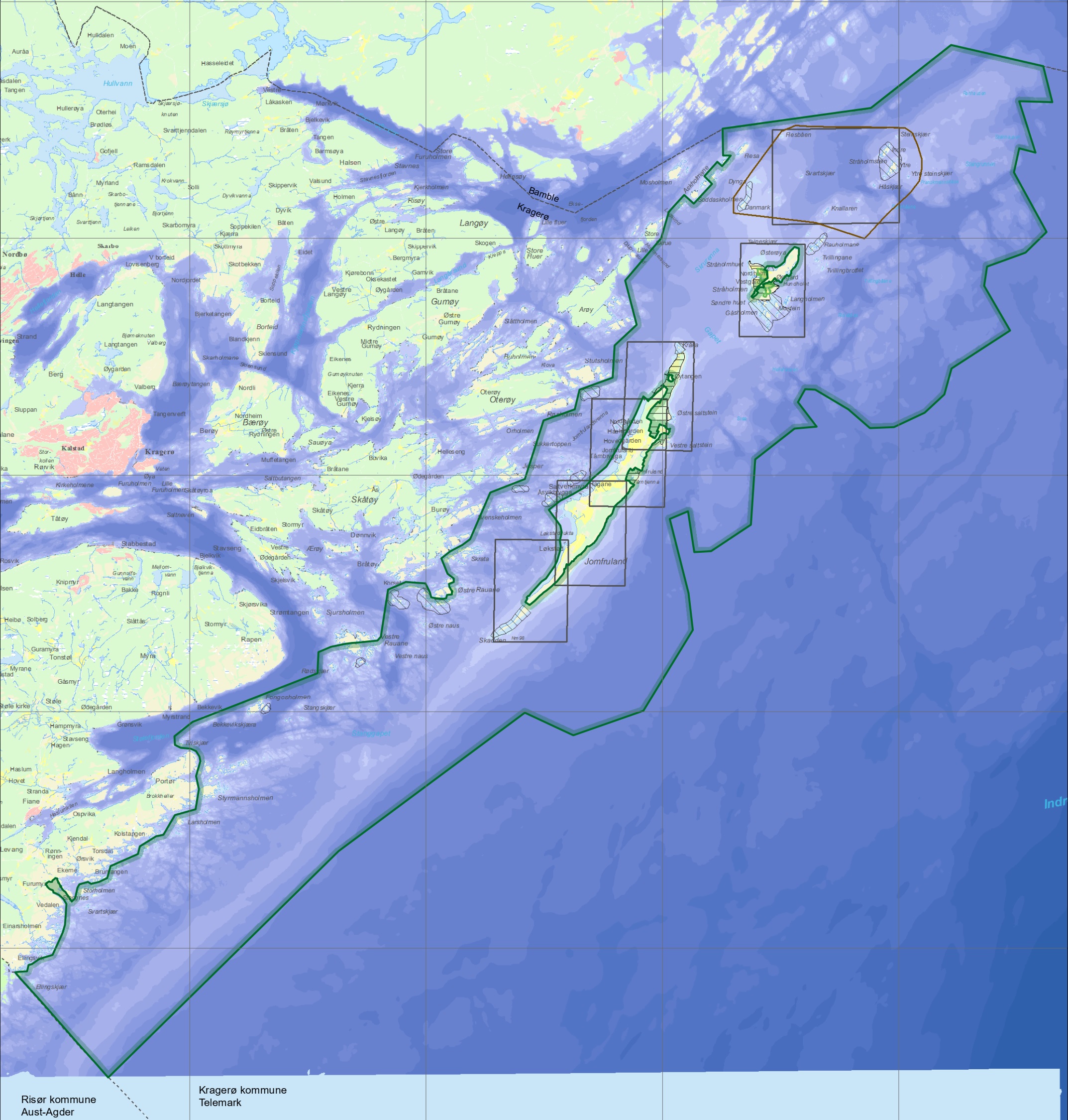
DETAIL MAP
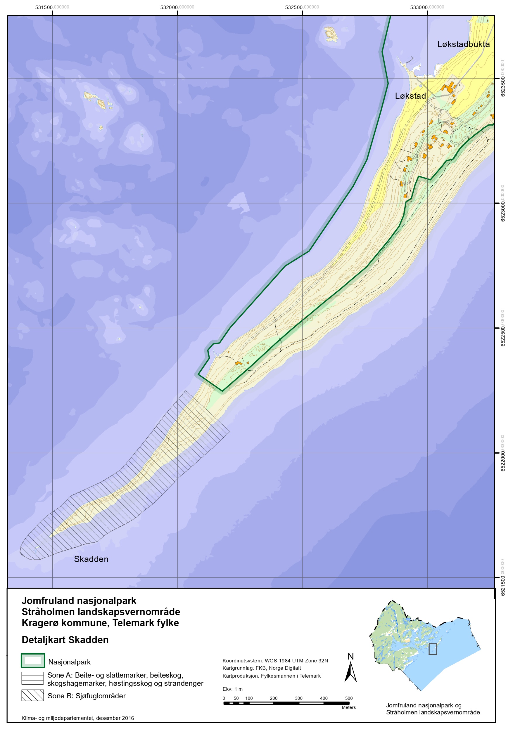
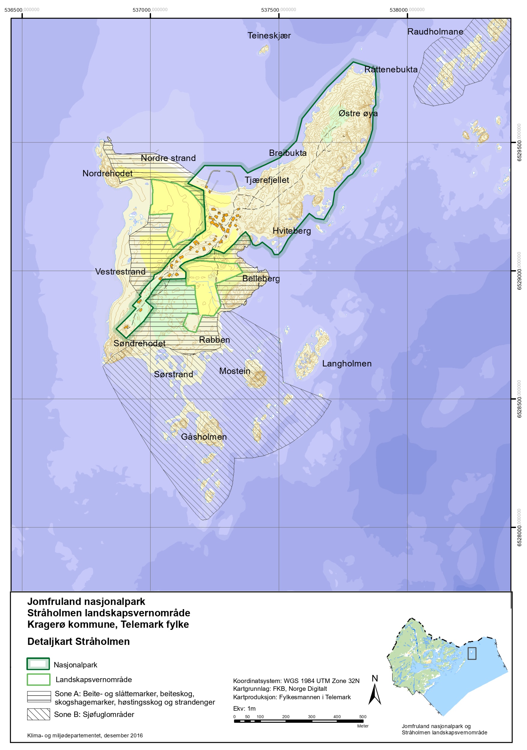
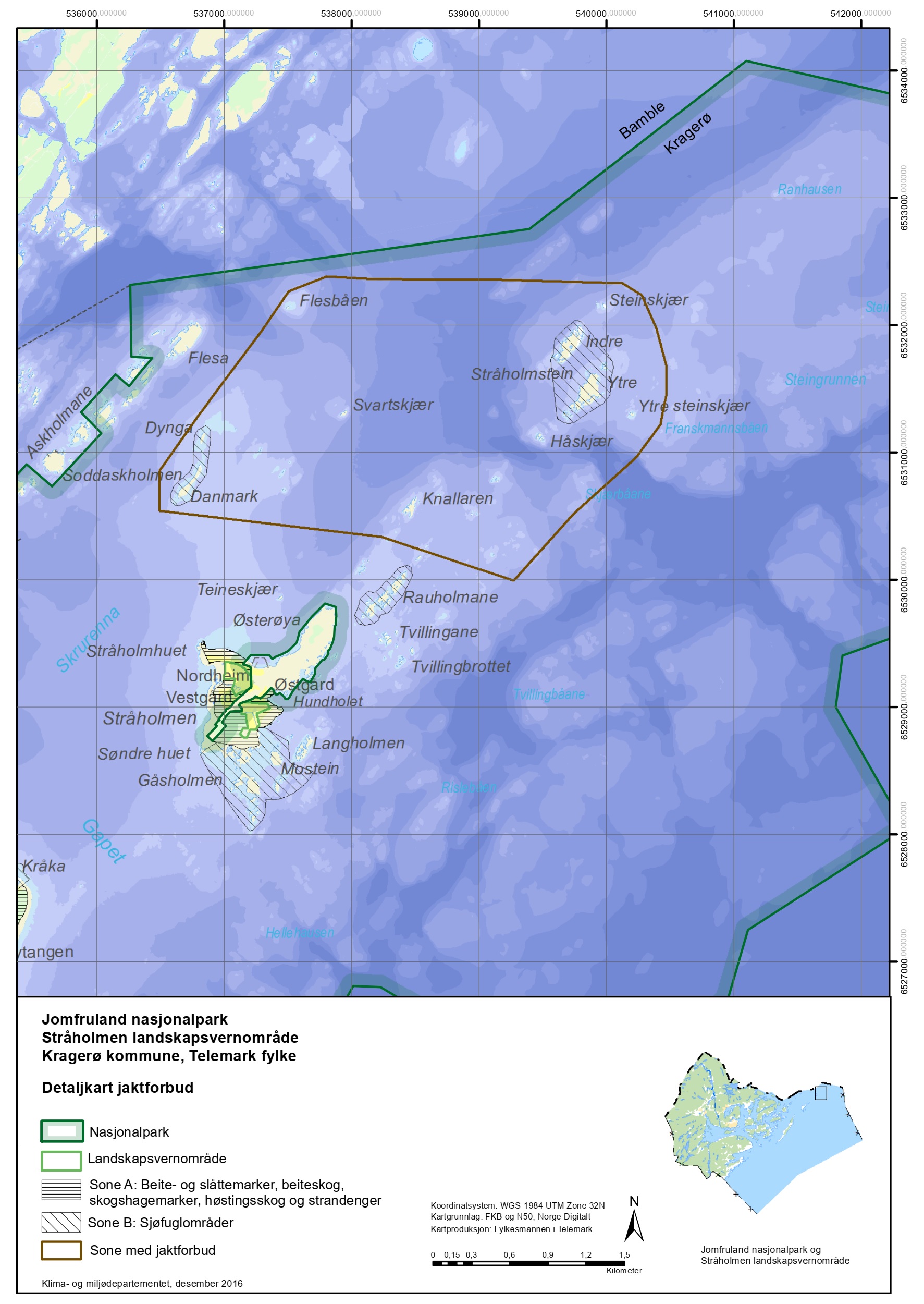
Jomfruland National Park has a rich plant and animal life. The park has 15 areas with a traffic ban from April 15 to July 15 (zone B), as well as areas with special rules for stays. Here you will find a detailed map with restriction areas around Stråholmen and Jomfruland within the national park.
Øytangen
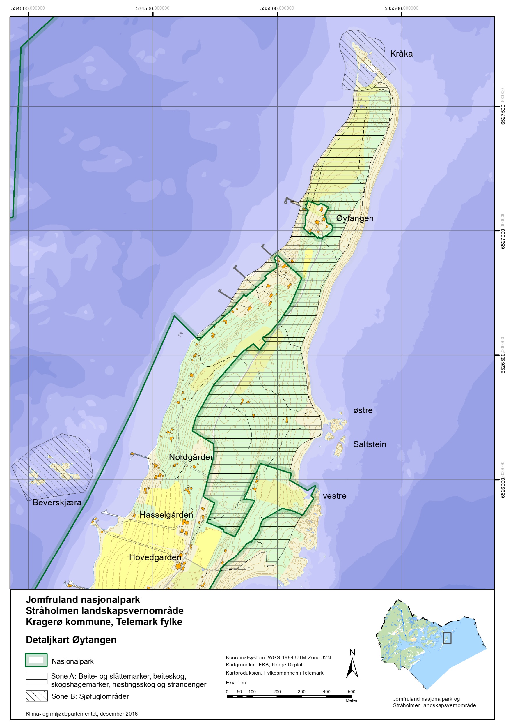
Tårntjenna - Salt stone
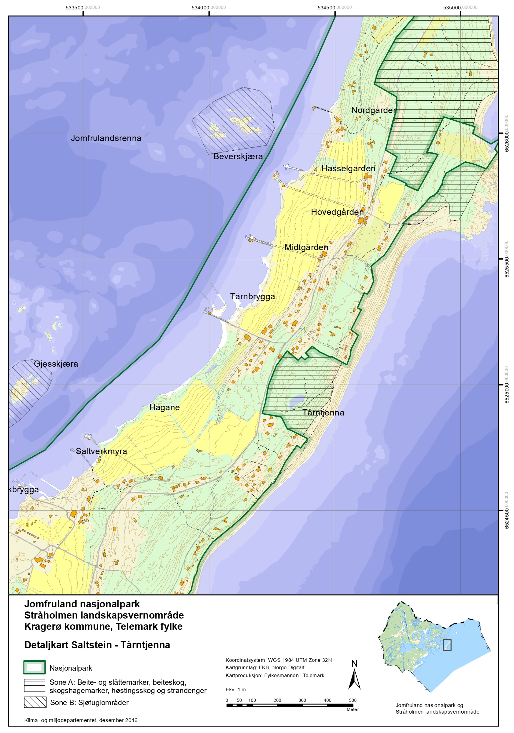
Kleiva - Skagerakstrand
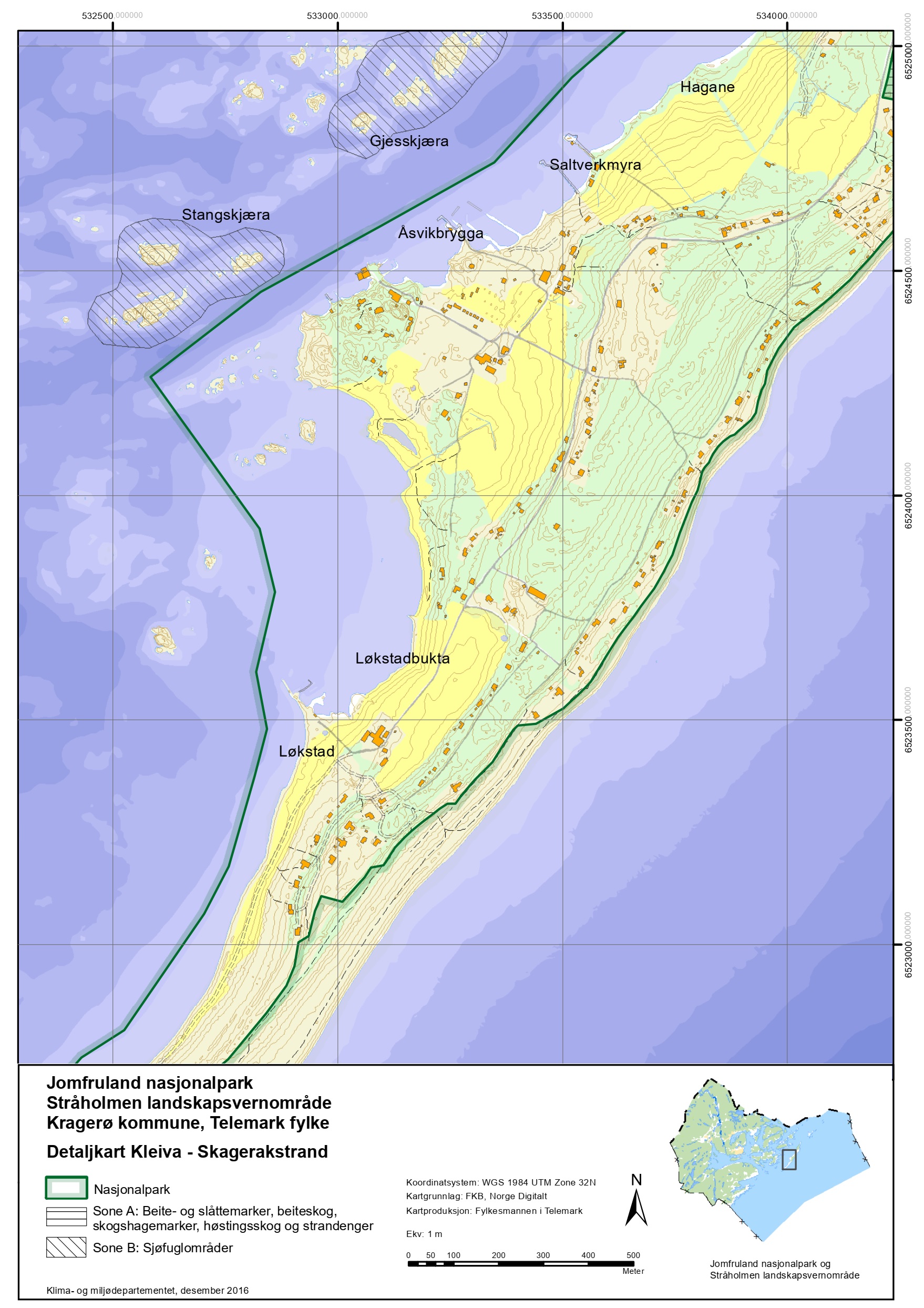
Skadden
Stråholmen
Zone with hunting ban
Overview map of Jomfruland National Park with restricted areas
